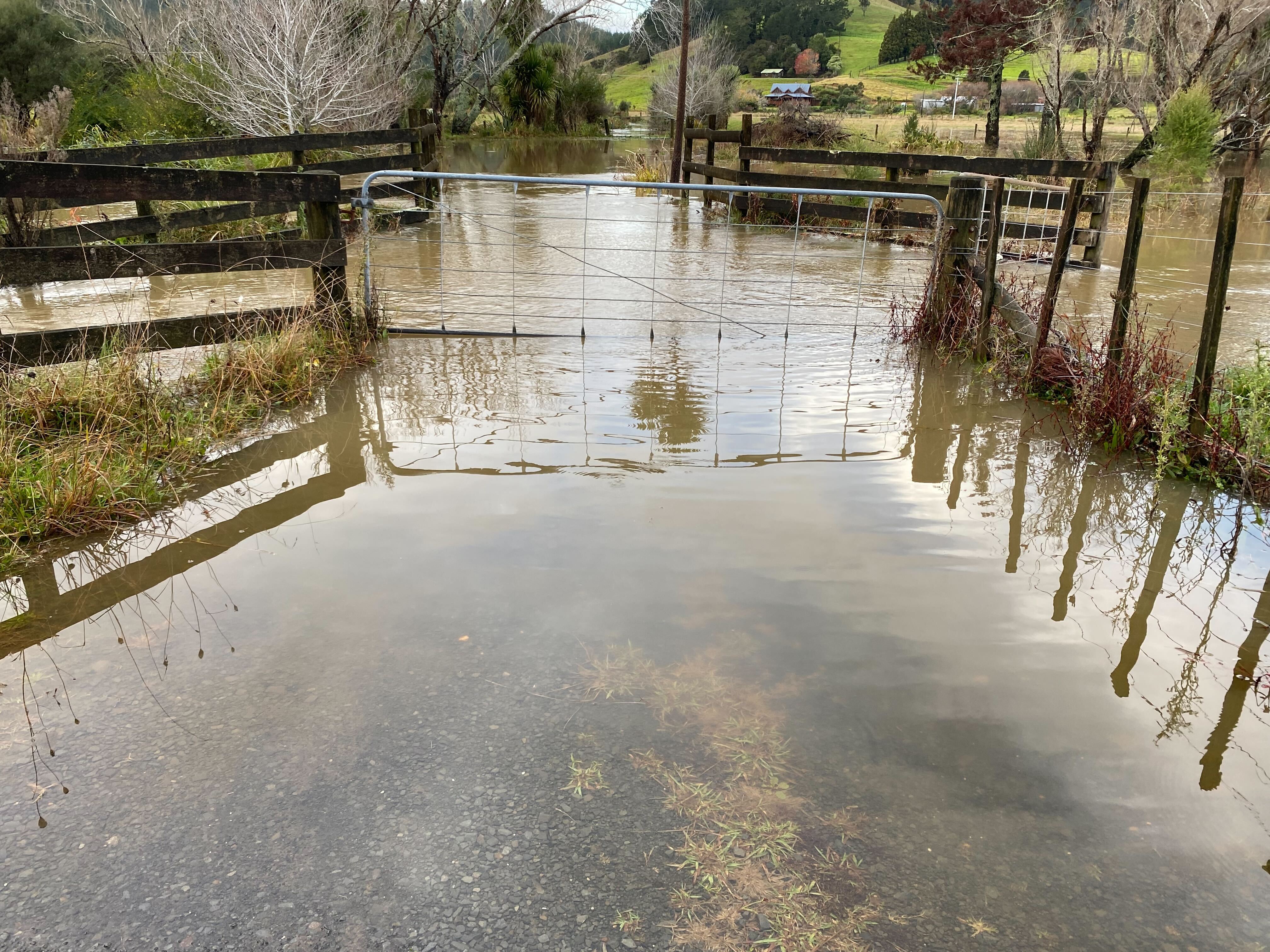
Weather: Flooding across the country, severe weather advisories issued for North Island, warning of flash flooding and thunderstorms
Stream levels are subsiding after Ngongotahā residents on the shore of Lake Rotorua were told to self-evacuate this morning.
Torrential downpours caused the Ngongotahā Stream to rise, peaking at 5.39 metres at 10.35am, Bay of Plenty Regional Council said.
Rain is forecast to continue in the east of both islands on Wednesday, NIWA has reported.
In the eastern North Island, it could continue into Thursday.
Just before 1pm, the stream had dropped to 4.964m and continued to subside.
Rotorua Lakes Council earlier advised Western Rd residents to leave their homes due to stream levels rising.
Fire and Emergency New Zealand said five crews had been at Western Rd providing help to those self-evacuting.
A spokesman said the situation was now de-escalating and two crews remained on standby at Western Rd.
Bay of Plenty Civil Defence had warned residents to prepare to evacuate. ”This is not a declared state of emergency, but we are closely monitoring the situation to do whatever is needed to keep people safe,” the agency said on social media.
Select students from Tolaga Bay Area School were sent home due to a risk their bus route could become flooded.
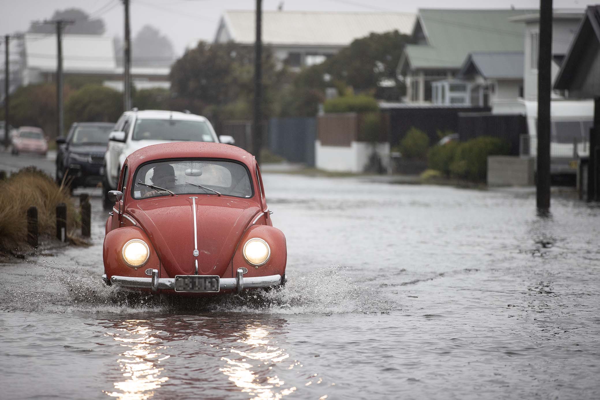
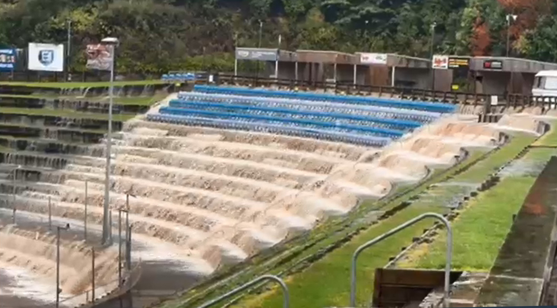
There is widespread flooding across the country, with streets underwater in Christchurch and waterfalls cascading down stands at the Rotorua speedway track.
An East Auckland resident said roads there were “transformed into a raging torrent”, cars were submerged and homes were damaged in last night’s downpours.
Firefighters dealt with at least 70 weather-related jobs overnight in the north of the country after a series of severe weather advisories were issued for the North Island.
STORY CONTINUES AFTER LIVEBLOG
MetService severe weather warnings
Tom Dillane
Heavy rain and strong winds for central parts of New Zealand
A subtropical low and associated front is forecast to bring further rain to eastern and central parts of New Zealand. Strong to gale force south to southeast winds are also likely in exposed parts of central New Zealand for a time.
Please stay up to date with forecasts.
Heavy Rain Warning - Orange
Impact: Heavy rain may cause streams and rivers to rise rapidly. Surface flooding and slips are also possible and driving conditions may be hazardous.
Area: Hawke's Bay about and north of SH5
Period: 46hrs from 8pm Tue, 21 May - 6pm Thu, 23 May
Forecast: Expect 120 to 170 mm of rain on top of what has already fallen, with the largest accumulations likely about ranges. Peak rates of 10 to 20 mm/h.
Area: Hawke's Bay south of SH5
Period: 34hrs from 8pm Tue, 21 May - 6am Thu, 23 May
Forecast: Expect 100 to 150 mm of rain about the coastal hills and ranges, and lesser amounts elsewhere. This is on top of the rain that has already fallen. Peak rates of 10 to 20 mm/h.
Area: The Tararua District and Wairarapa
Period: 19hrs from 8pm Tue, 21 May - 3pm Wed, 22 May
Forecast: Expect 50 to 80 mm of rain about the coastal hills and ranges, and lesser amounts elsewhere. This is on top of the rain that has already fallen. Peak rates of 10 to 15 mm/h.
Heavy Rain Watch
Area: Kaikoura Ranges
Period: 16hrs from 8pm Tue, 21 May - noon Wed, 22 May
Forecast: A period of rain, heavy at times, and amounts may approach warning criteria.
Strong Wind Watch
Area: North Taranaki
Period: 12hrs from 10pm Tue, 21 May - 10am Wed, 22 May
Forecast: South to southeast winds may approach severe gale in exposed places.
Area: Horowhenua, Kapiti Coast and Wellington
Period: 14hrs from 8pm Tue, 21 May - 10am Wed, 22 May
Forecast: South to southeast winds may approach severe gale in exposed places.
WARNINGS NO LONGER IN FORCE
Heavy Rain Watch lifted for : Tairawhiti/Gisborne: Widespread heavy rain has eased so the watch is lifted. However, another period of heavy rain is possible on Thursday and a new watch or warning may be issued on Wednesday morning.
Tom Dillane
Tom Dillane
Lines company workers save motorist stuck in rising Rotorua floodwaters
Tom Dillane
Two “humble” workers from a lines crew who jumped into rising floodwaters near Rotorua to rescue a woman from a sinking car “likely saved a life today”, police say.
Police say the driver called emergency services about 1pm today, saying she was stuck inside her car on a flooded patch on Waikaukau Road at Ngakuru, south of Rotorua.
The vehicle floated into deeper water and then started sinking.
The driver was unable to open the doors or windows and told the call taker the water was up to her chest and still rising.
The call taker stayed on the line with the woman as units, a helicopter and swift-water rescue team were deployed.
Police said two workers from a lines crew who saw the incident unfold jumped into the water and smashed the window to pull the driver to safety.
Tom Dillane
Tom Dillane
Tom Dillane
Rotorua residents advised to prepare to self-evacuate
Tom Dillane
Primary Local Controller Stavros Michael said the Rotorua Lakes Council had advised residents to prepare to self-evacuate.
“Our advice is to go to friends or family but otherwise move away from the waterway to a dry, safe location,” Michael said.
He was not aware of any damage to homes at this stage.
Bay of Plenty Regional Council said the Utuhina Stream level peaked at 5.39 meters at 10:35am today.
At 1pm it was 4.964 meters and was continuing to subside.
Warning to conserve water in Wairoa, Hawke’s Bay, as wastewater system becomes overwhelmed
Tom Dillane
Sophie Ryan
Nearly 1000 without power overnight in Bay of Plenty
Sophie Ryan
About 970 households across the Bay of Plenty region lost power last night due to extreme weather including high winds, lightning strikes and rain, a Powerco spokesperson said.
About 24 on Matakana Island of the original 197 were still without power after lines came down, and in Paengaroa 89 customers were waiting for their power to be restored.
In Waihī, 165 customers lost supply at midnight after vegetation blew into lines and fault crews were stood down due to the foggy conditions. It was back on by 9.05am.
Te Puke also had houses lose power last night.
Sophie Ryan
Sophie Ryan
Sophie Ryan
Flooding in Tokoroa
Sophie Ryan
Flooding in Tokoroa, South Waikato
Heavy rain warning - Orange for Hawke's Bay, Tararua District and Wairarapa
Sophie Ryan
Sophie Ryan
STORY CONTINUES
Torrential downpours hit parts of Auckland and Coromandel overnight, bringing “damaging” amounts of rain to some spots, according to MetService.
Forecaster Niwa reported northern parts of Auckland experienced “near-record” rainfall.
MetService issues swathe of new warnings, watches
MetService has issued fresh warnings for Hawke’s Bay, urging residents to prepare for surface flooding and slips.
The forecaster said areas south of SH5 will see the largest amounts of rainfall, with 150 to 200mm of rain expected on top of what already has fallen.
Areas north of SH5 are expected to see an additional 20 to 40mm.
The Tararua District and Wairarapa are tipped to see 130mm to 160mm of rain, with peak rates of 15mm to 20mm/h.
Gisborne and the Kaikōura Ranges are currently under a heavy rain watch, with Gisborne potentially in for thunderstorms this afternoon.
A strong wind watch will come into force for North Taranaki and Wellington at 8pm tonight.
Meanwhile, further south, heavy rain in Christchurch this morning also flooded streets, bringing traffic to a crawl.
Surface flooding across Marine Parade at the city’s beachside suburb of New Brighton has made residents anxious.
‘A jet ski could easily ride on the field’, speedway flooded in Rotorua
The speedway track in Rotorua was also flooded after a torrent of water gushed down its terraced grandstand.
Rob Prior, who is staying in a motorhome nearby, said the flooding peaked at 8.45am.
He said water was running down the terraced seating and the track was filled up.
The rain had now subsided, with the waterfall slowing.
Police had blocked off about 100m of the road opposite the stadium and there were 10 to 15 people at the scene, Prior said.
He described the scene as “nuts” and said a jet ski could easily ride on the field.
‘Raging torrent’, flooding turns streets into rivers in East Auckland
St Heliers resident Matthew Davidson said the rain was “relentless” from 9pm to midnight.
“Multiple manhole covers burst under the pressure at the bottom of Tarawera Terrace and this transformed the roads into a raging torrent,” Davidson said.
He said the floods brought back memories of last year’s wild weather as he watched cars become inundated and the water flooded neighbours’ homes.
“I’ve spoken to some of the impacted residents and they are having to lodge insurance claims this morning due to the flood damage,” Davidson said.
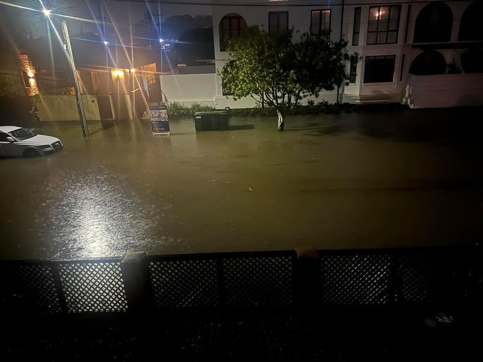
Transport Minister Simeon Brown posted to social media that traffic was gridlocked due to surface flooding around Pakuranga Plaza.
North and East Auckland bore the brunt of the downpours but the Auckland Airport and Manukau weather stations had also received around 30mm in an hour, with 7mm considered heavy rain.
Flooding has also been reported in the Coromandel and Putāruru. More than 40mm fell in an hour over the Coromandel Range and thunderstorms remained over the Kaimai Range just before 6am.
Northern firefighters responded to 67 weather-related callouts between 11pm and 2am, Fire and Emergency New Zealand shift manager Josh Pennefather said.
There were also 28 alarm activations in commercial buildings due to water ingress.
Fire and Emergency New Zealand has also responded to four flooding-related callouts in Putāruru as of 7.30am - mostly clearing drains - as thunderstorms and heavy rain hit the South Waikato town overnight and this morning.